I’ve spent a good deal of time in the North Indian state of Himachal Pradesh. I’ve passed more days wandering its forested slopes and meandering its river valleys than any other state on the subcontinent and I’d venture to say that it’s one my favorite places – maybe on the planet.
June is the last gasp of summer in Himachal before monsoon season, so time is growing short. The Spiti Valley, located in the northeast corner of the state, is a place I haven’t yet reached. The name “Spiti” means “the middle land”, as it’s located between India and Tibet. It’s a cold mountain desert with a rugged landscape. Windswept and harsh, it’s punctuated by quiet little villages and thousand-year old monasteries that time forgot.

The roads in and out are impassable much of the year and barely passable otherwise. Come winter, the valley is completely cut off from the outside world. Even in the summer, it’s no easy feat.
Glaciers that swallow up the roadways late in the year never quite subside . What is relinquished to the rivers is done so in angry torrents that taunt the the hubris of those who thought to build roads in such a godforsaken place.
The Spiti Valley is on the bucket list of any itinerant traveler of India, and being something of an enthusiast myself, it’s something I have to see.
Manali
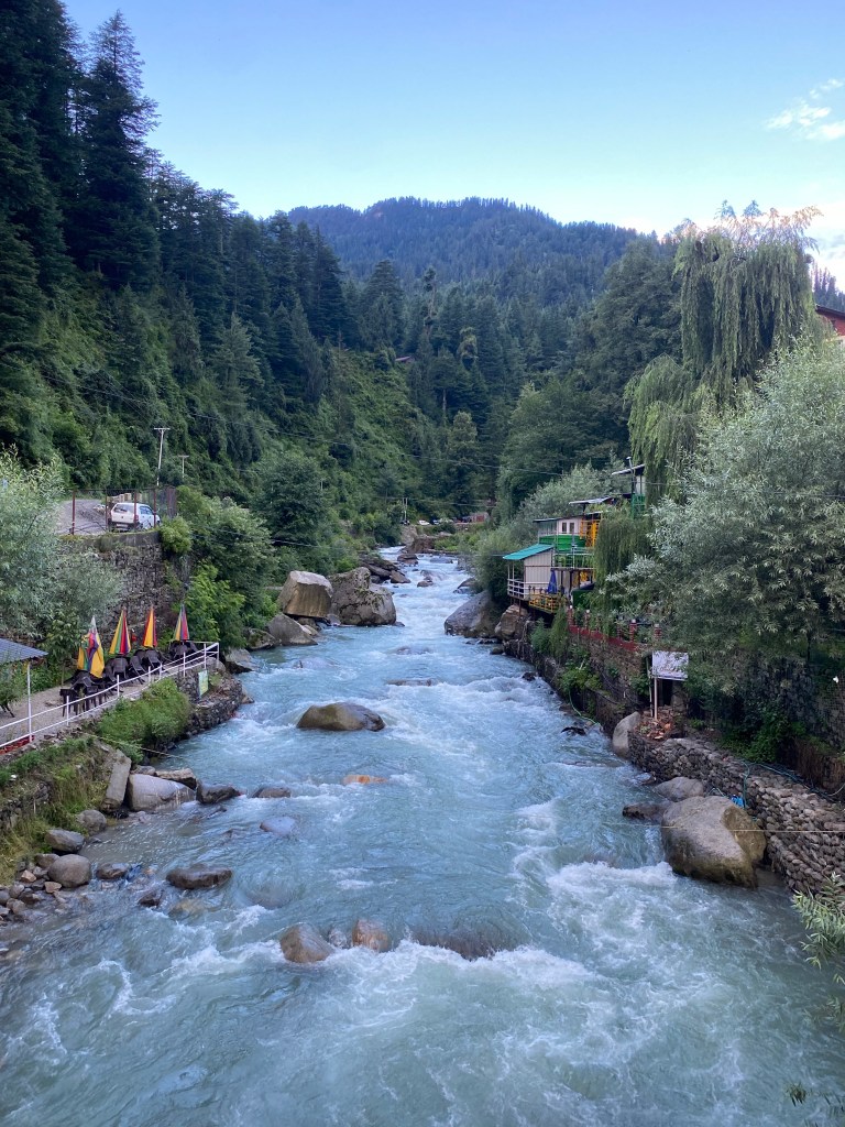
Manali is my jump-off point. It’s a popular tourist destination known as much for its outdoor adventure sports as for the plentiful hash that makes its way up from the Parvati Valley. There’s river rafting and paragliding, and even snow skiing in the cooler months.
June is the peak of high season and it’s crowded. Central Manali is a small city with raucous bazaars and lots and lots of people. Old Manali, just across the Manalsu River on the north side, is a little quieter and a lot more bohemian. I’ve been through Manali a few times, and it’s always where I plant my flag.

I arrive in with the idea of taking public buses into and around the Spiti Valley. Being a solo traveler on a budget, it’s the logical choice. Even so, it promises to be a punishing ride – as local buses always are.
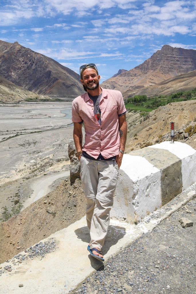
I plan to head east towards Kaza first, moving clockwise through Spiti and finishing in the Kinnaur province. When I inquire at the bus station though, I learn that service into the valley is suspended. More likely, it never started. The summer of 2023 never really materialized in Himachal and the snows haven’t receded enough for the lumbering buses to make it through the passes.

Plan B is a shared taxi to Kaza, and then buses the rest of the way. I’m all set to book a seat, when I cross paths with some fellow travelers planning to hire a driver for the route. Their 10-day itinerary will cover everywhere I want to go, minus the headaches, and body aches, of bus travel.
We’re set to leave the following morning.
Jibhi
The average elevation of Spiti Valley is 12,500 feet. Going counterclockwise, through Kinnaur allows for a more gradual climb and more time to acclimate to the altitude. I’m a pretty tough bird, sometimes obstinately so, but I got rocked for days by the altitude in Ladakh last year, so it seems like a good plan.
The ride from Manali to Jibhi is a mostly straight shot on a wide stretch of highway that runs south along the Beas River. It’s only about 70 miles and we arrive before lunch.

Surprisingly, prices for accommodations are higher in these little villages than in larger towns. I’d been told as much. A mediocre room in Jibhi is almost double that in Manali. Sharing rooms helps defray the cost, and with five of us, we have some bargaining power.
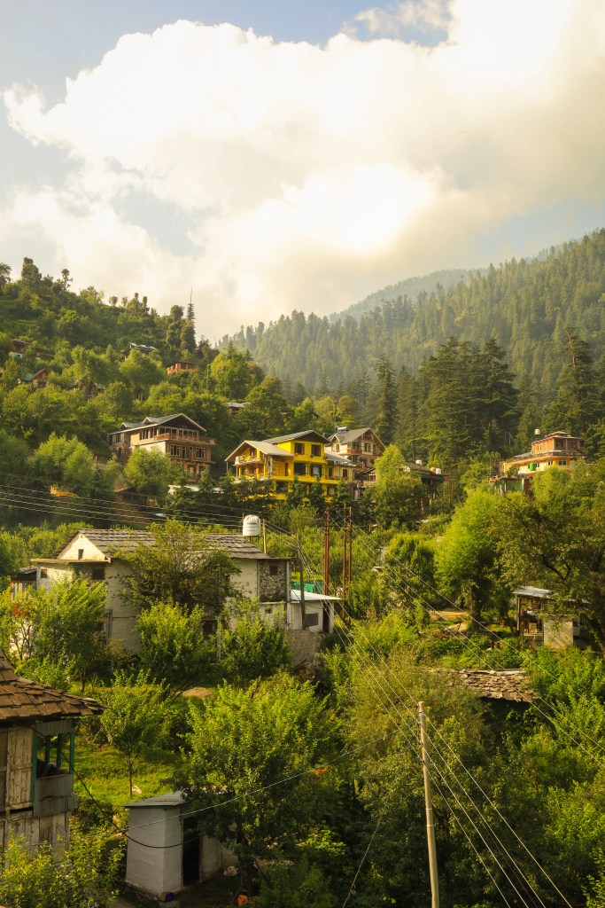
Jibhi is just a little hamlet arranged along a few curves on a mountain road. It’s woodsy and welcoming. Little cafes are set in the shade of tall pines and terraced hillsides, along a clear stream that runs through the Tirthan Valley.

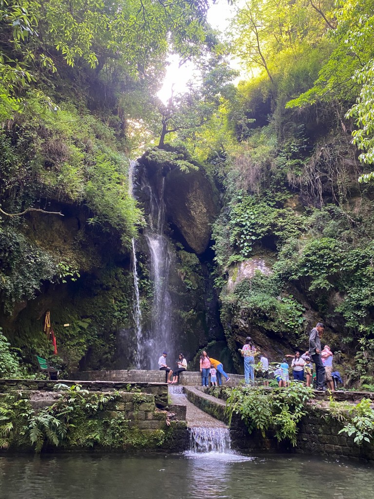
After the first of many vegetable thalis, we walk the stream to the Jibhi Waterfall. The sole tourist attraction in the village, it’s nice enough, if a little crowded and a lot curated. A ticket booth at the entrance is a sure sign it’s not terribly authentic.
.
A post-lunch rumble in my belly deteriorates over the course of the afternoon until a prone position is the only tolerable one. My choice to drink the water proves to be the wrong one and I spend the remainder of my stay in Jibhi alternating between a mattress and a toilet seat.
Jalori Pass

Whatever I had me down moved through me pretty quickly (quite literally) and I feel mostly human by morning.
It’s about 45 minutes to Jalori Pass, our first summit of the trip. It’s situated over the Banjarmasin Valley at 10,300 feet. We grab bread omelets (exactly what it sounds like) and chai at the one of the few dhabas on the pass and walk up to Raghupur Fort.

The 2-mile hike that starts as a mellow path through a forest of oak and rhododendron, and then rises steeply over the tree line into a huge alpine meadow. The fort, the highest in India, is just a collection of crumbling stone walls, but views of the valley and Himalayas to the horizon is worth the climb.
Sarahan

It’s late afternoon when we arrive in Sarahan, “the gateway to the Kinnaur Valley”. Our rooms at Nalanda’s Homestay look out from series of cliffs towards the Sutlej River. Opposite the valley, we are surrounded by apple orchards and forests.
The Bhimakali Temple is the centerpiece of Sarahan. It’s one of 51 Shakti Pithas, or pilgrimage sites for Shakti Devotees, and it dominates the village. It’s similar in style to other North Indian Hindu temples, but on a much grander scale.

After sunset, I go for a visit and pass a boisterous procession spilling out into the village. Some men hoist an effigy of Kali, others march along with horns and drums.
Many temples don’t allow foreigners to enter, so I proceed cautiously. I remove my shoes and tuck my camera away. This, being a pilgrimage site, proves to be more welcoming. I stow my things in a little locker and follow the sound of the bells towards one of the wooden towers.
I climb the rambling stairway to the top and into the inner sanctum. A Hindu priest is performing evening darshan before the goddess. It’s an ancient ritual of chants and offerings and bell ringing performed every night before the shrine is closed.
I sit before Ma Kali, the universal mother, with her fierce countenance. Her great destructive powers are seen as a vehicle of salvation and ultimate transformation. Her power is time, which devours all.

It’s believed that she goes into the darkness with us to swallow our sins so that we can transform our lives. If you can surrender fully, she will bring you back cleansed, transformed, and whole.
I center myself and offer up that which I seek to purify. When the darshan ends and the shrine is closed, I walk enchantedly into the cool night air in a sort of spiritual daze.
Chhitkul

The road from Sarahan descends on a spidery route towards the river and into the Kinnaur Valley. It takes the better part of an hour to get to the main road, low on the mountain face, and still, the riverbed sits far below.
The roadway, typical of the Himalayas, is blasted from rock face. Traffic crawls along a thin, high lip as it passes through cavernous blast cavities and hugs the mountainside. On the right is a wall of rock and the left, a a lateral drop.

Where the Sutlej River meets the Baspa, we take the spur into the Baspa Valley towards Chhitkul. As we climb higher the temperature drops lower. Kinnaur called “the land between paradise and earth” – and for good reason.

It’s something of an Eden. Below snow peaks, pine slopes give way to orchards and farmland on the valley floor. Even the peak in the distance, Mount Kailash, is the stuff of myth and legend.

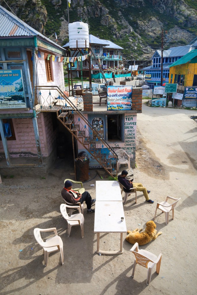
Chhitkul is the last inhabited village in the valley. It’s 44 miles to the Indo-Tibet border and no civilian movement is allowed beyond this point. Around the village, people work plots of land terraced into sections by neat stone walls. It’s cool and gray and misty when we arrive, with not another foreigner in sight.

It’s quiet here. No one passes through Chhitkul on their way to somewhere else. At 11,320 feet, it’s not terribly accessible. It’s just a little farming village at the end of a very, very long road. Aside from the villagers’ homes there are a few guesthouses and campsites. Many villagers move to lower elevation before the snows arrive. If you come to late in the year, you’ll likely stay until spring.

Our walk up the river is scuttled by an afternoon rain but the sky clears late in the day, leaving the air crisp and clean. I walk through the village, among the timber houses and temples, in the amber light just before the sun drops behind the mountaintops.
Kalpa
In order to proceed beyond Kinnaur and into the Spiti Valley, foreigners need to obtain an “inner line permit” at Reckong Peo. While India is, by most accounts, a liberal democracy, there’s a strong air of authoritarianism in the disputed border regions. Beyond Kinnaur, the route butts up against the Indo-Tibetan border, where there are a whole lot of men in a whole lot of camouflage.
Reckong Peo is the capitol of Kinnaur. It’s a busy little town as things go, and a stark contrast to the sleepy little villages we’ve just been through. About six dollars and copy of your passport will get you a permit good for two weeks in the valley. We stay in Reckong Peo long enough to get our permits and continue to Kalpa.

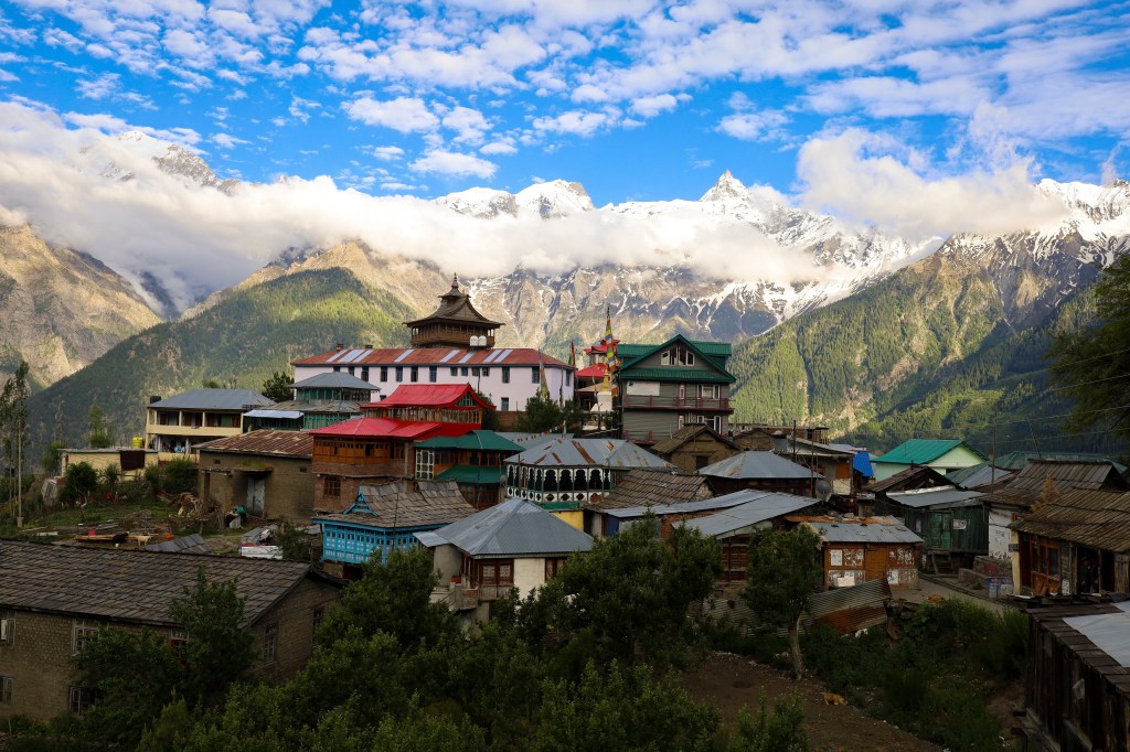
Kalpa sits on a rise in the valley above the Sutlej River. Amid the jumble of houses, Buddhist and Hindu temples sit shoulder to shoulder. The backdrop is the Shivling Peaks, a cathedral of rocky crags reaching over 20,000 feet.


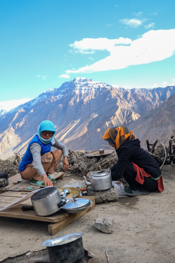
While the scenery changes a lot from place to place, the accommodations and meals don’t. Guesthouses are basic but clean and the prices are pretty standard. Most also offer food but the options are limited. I fall into long succession of vegetable thalis and stir fried noodles with an occasional order of momos thrown in for good measure.
We plunk down for the night at the Hotel Blue Lotus. It has a huge covered porch that overlooks the whole village. Another misty afternoon clears in time to see the Shivling Peaks painted in gold and the village like something out of a children’s storybook.

Nako
Less than forty-five minutes outside of Kalpa, the landscape transforms completely. Gone are the pine trees and any trace of green, replaced by rock. We’re surrounded by rock, insanely huge piles of it, and endless, barren mountainsides striated in red and brown and gray.
It’s so desolate and stark, more like a moonscape than a landscape. It’s a different kind of beauty; a barren majesty. It’s like a painting that I might admire in a museum but would never hang in my own home.

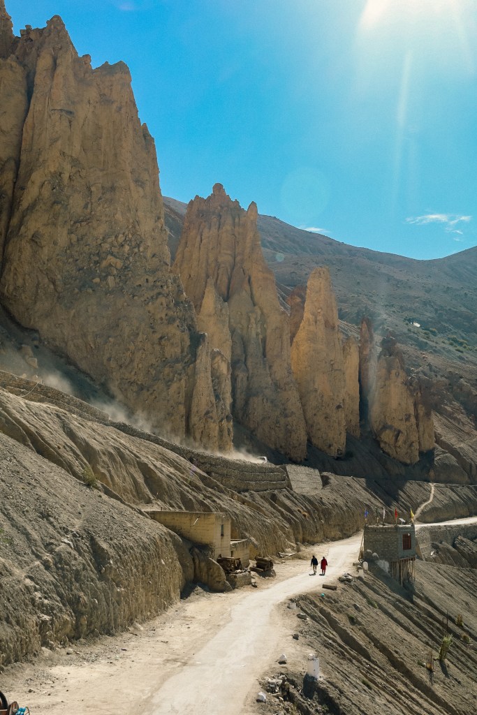
The village of Nako sits at over 12,000 feet in this mountain desert. It’s harsh, rocky, and bleak, and completely exposed to the blazing summer sun.

The houses are made of white-washed mud and stone with large stacks of firewood on the rooftops – a preparation for the biting winters that are never far off. There’s an 11th century Buddhist monastery and ancient stupas that rise under tattered flags on surrounding hillsides.
In the center, surrounded by a line of poplar trees, Nako Lake forms a small oasis. Locals believe the lake to be created by the gods, and so it’s considered sacred. It is miraculous that a lake can exist here, in this unsheltered place that sucks the very moisture from my body.
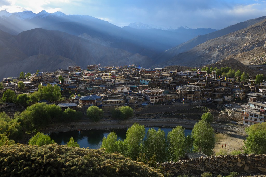
The village is out of another time. A labyrinth of alleyways cut between the mud houses and livestock pens, where I’m mercifully shaded from the sun. Buddhist prayer flags fly from vertical posts set into the buildings, adding little splashes of color to the austerity.

I walk to a large stupa overlooking the town and the little lake. All around me, thousands of rock shards carved with Tibetan scripture are gathered into great piles. I try to imagine how long it would take to complete just one with the rudimentary tools of a thousand years ago, and then multiply that by the countless stacks of them.
It’s simply mind boggling. The dedication of the monk-craftsmen and their devotion to the teachings stirs something deep inside of me.

I can see other shrines farther up the hillside, but the sun is intense and distance is deceptive.
I’m always up for a walk in a forest. You never know what’s around the next corner. It’s a series of constant discovery. In a desert though, you see everything long before you reach it and there’s very little surprise. Everything is always farther away than it looks and just gets bigger as you near it.
It’s pretty like a picture, but I prefer a walk among the trees any day.

Dhankar
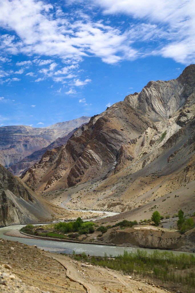
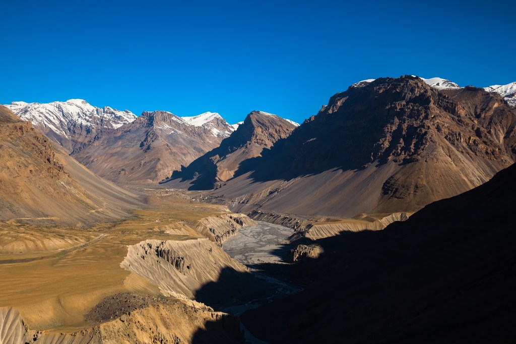
From Nako, we follow the Spiti River into its namesake valley. The views are unparalleled. The valley is the vastest of canyons with a wide, flat bottom, and the the river, a braid of burnished steel at the center.
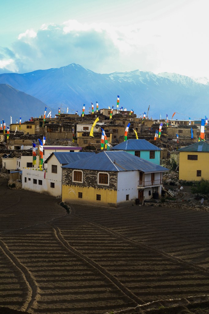
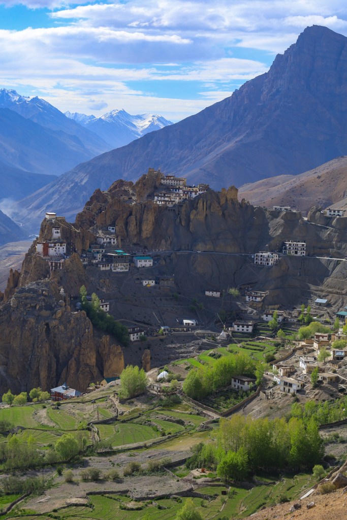
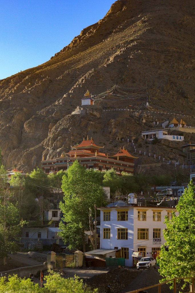
Dhankar is anchored to a cliffside high above the valley floor. At, 12,800 feet, it overlooks the junction of the Spiti and Pin rivers. In its center, a 1000-year-old monastery springs from rock crevices. Below, patches of green farmland defy the severity of the landscape.

This village of 400 was the original capital of the Spiti Valley Kingdom. A fortress monastery, one of the oldest in the valley, sits on a 1000-foot rock spur. During the 17th century, rulers favored this spot because it gave a clear view of invaders and was easy to defend. The word “dhang” means cliff and “kar” means fort , so the literal name of the village is “fort on a cliff”.
The monks who built the monastery saw the surrounding pinnacles of rock as the leaves of a giant lotus flower – sacred in both Buddhist and Hindu philosophy. The monastery and the village form the heart of the lotus as it were.
We get rooms near the monastery at Tashi Homestay and hike up to Dhankar Lake. The lake is a little more than a mile from the village on a steep gravel path. It’s a glacial lake fed by snowmelt, clear and cold but its rather shallow this time of year.

Back in the village, I climb to the old palace at the top. From here, I can see the whole of the Spiti Valley, the meeting of two rivers and the entrance to the Pin Valley beyond.
Below me, the rooftops of Dhankar are laid out like a series of stair steps. Much of the village is gathered on one of them. As I pass, a man motions for me to climb up and join what turns It turns out to be a funeral celebration.
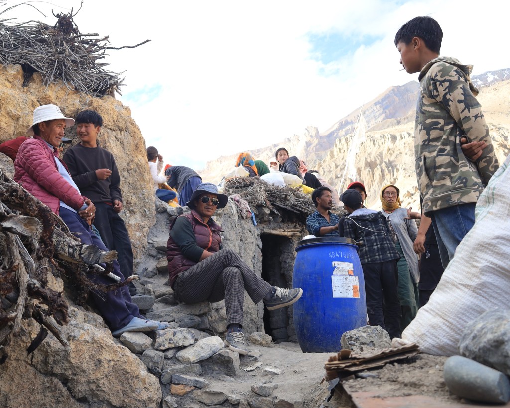
It’s not a somber affair, there actually seems to me mostly merriment. We share chai and biscuits as one of the younger guys helps to translate. Most have never met an American but with all of the pop culture flowing from the states, there’s a level of familiarity and I’m treated as something of a minor celebrity.
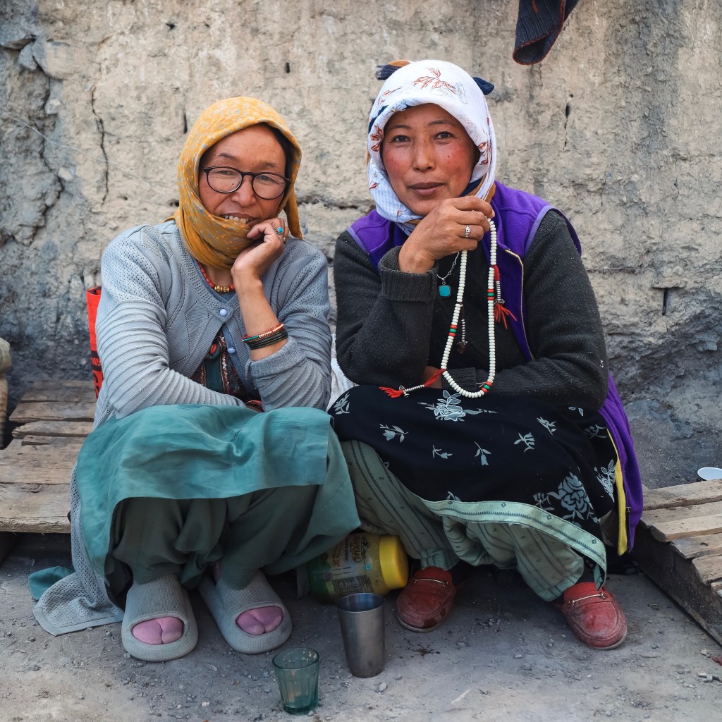
On the ground floor, a group of women are gathered in a dimly lit room. Sensing my curiosity, they beckon me in. Dozens of candles flicker against the far wall, casting the room in a yellow glow. They sit in puja for the dead, helping to ensure a positive rebirth in the next life. Here too, there seems to be very little mourning. They chuckle to themselves and smile at me as they perform their part in this, the natural cycle of things.

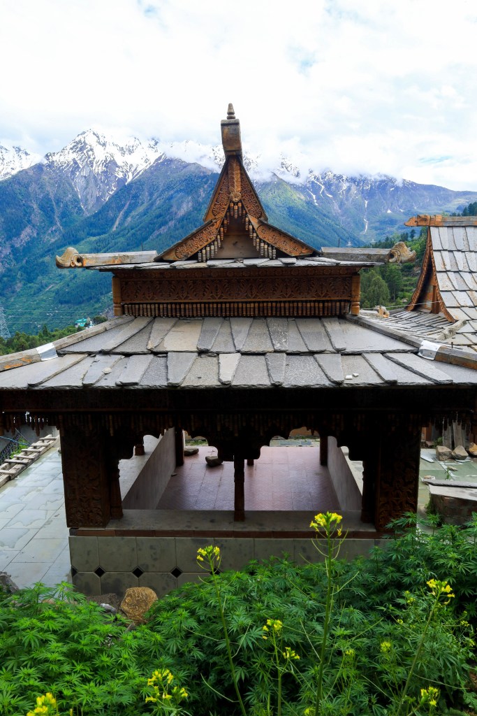
I stop at the Dhankar Gompa on my way back to the guesthouse. The walls are built very thick and the ceilings low, easier to keep warm during the frigid winter. I climb stone steps and wooden thresholds, worn smooth and glossy by a millennium of human touch, and sit in the silence before a silver statue of Vajradhara, the Diamond Being.
Mudh

Past Dhankar, we cut northwest for a detour into the Pin Valley. The roads of black asphalt are behind us and we crunch over pitted gravel, dodging larger rocks that have fallen to the roadway. Also gone are guardrails or the giant stones placed to keep cars from careening off the edge.
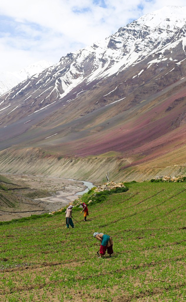
The scenery is exceptional. The Pin valley is as vast but much greener than the Spiti. Though it’s too high for trees, the mountains are covered with grasses and shrubs and little villages pop up amid islands of emerald green terraces.

The growing season is mercilessly short here. Small groups huddle together in the fields working on their hands, while others maneuver long hoes over the soil. They grow all manner of vegetables to sustain them through the long winter months.

Mudh looks over a series of enormous green tiers that cascade down to the gravelly banks of the Pin River. It’s the smallest village we’ve visited – just a couple of square blocks really. It’s the beginning or endpoint to the Pin Parvati Trek: a walk takes you all the way to the Parvati Valley, and one that I very much want to do. Unfortunately, the snows didn’t recede in time this year so no one is going in or coming out.

We find a rooms at the Pin Parvati Hotel and then walk the first few kilometers of the trek. It’s gorgeous with long spans of green and even lavender splashed across the hillsides. In the distance you can see the snowcapped peaks of the Parvati Range.


Kaza

We retrace our path back into the Spiti Valley and I catch a last look at Dhankar on the mountain crest above. It’s only 31 miles to Kaza, but with the deteriorating road conditions it takes every part of two and a half hours.
Kaza is the headquarters of Spiti Valley and the largest town in the valley. That isn’t saying much, but it’s a good deal larger than the other villages we’ve seen. If I’d come from Manali, this would be my first stop.

Had I just arrived, I’d be more charmed, but it lacks the whimsy of the little hamlets we’ve just visited. It does, however, have some good cafes, a sizable bazaar, and the first phone reception we’ve had all week.

I find an exceptionally good dhaba, where I’m able to eat something apart from a vegetable thali, and climb to a giant Buddha statue that overlooks the whole town. The valley is wide and shallow here, and the city is built on a gentle slope towards the river. I enjoy a cup of real coffee and spend some time in the bazaar.

Key, Kunzum, and Chandra Taal

It’s not yet 6am when we pull out of Kaza. The mornings, like the nights, are crisp and cool. I’ve gotten a lot of mileage out of my fleece-lined jacket and knit cap.
About 9 miles out of Kaza, we reach Key Gompa – the largest monastery in the valley. Key Gompa is likely to be one of the first images you see if you Googled ‘Spiti Valley’. It’s iconic. Currently home to 200 monks, the monastery is a white walled honey comb of buildings covering an entire mountain peak.
The gates are open when we arrive, but it’s too early to really get into much of the interior. This is the earliest start we’ve gotten so far and the light is extraordinary. The contrast of light and shadow on a landscape of this scale is unparalleled.


It’s another two hours and a good deal of climbing before we reach Kunzum Pass, which connects the Spiti and Lahaul valleys. At just shy of 15,000 feet, it’s the highest point of our journey.
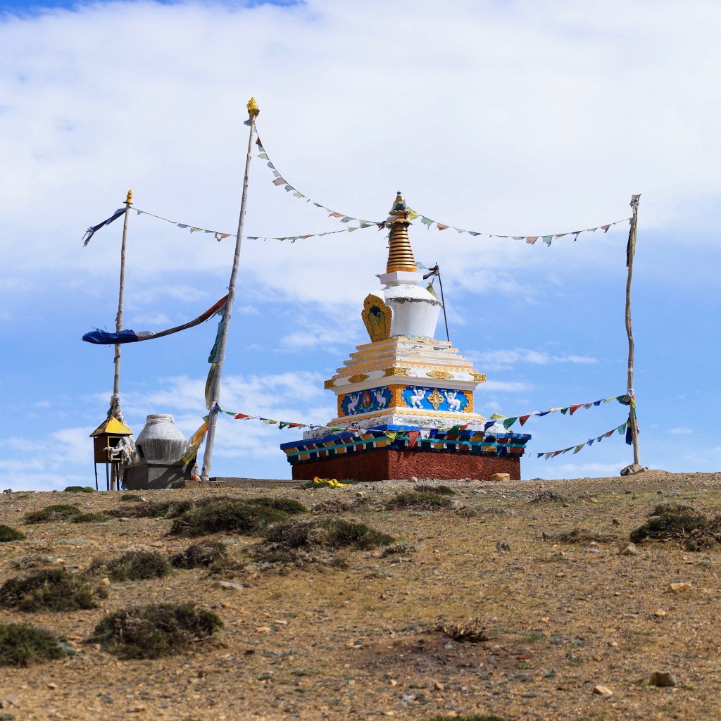
It’s cold and windy up top and the sun is blinding off of all of the surrounding snow. A Durga Temple and Buddhist stupas keep watch over the pass and Bara Shigri glacier, the largest glacier in Himachal Pradesh.
While the ascent to the pass was somewhat gradual, the descent is fierce. The gravel road turns into a gravel-bottomed stream. Between the walls of melting snowpack, it’s narrow and impossible to see around the switchbacks.
It’s no mystery now why the buses aren’t running. Oncoming traffic isn’t visible until the very last moment, and in order to pass, one vehicle must maneuver until cantilevered against a cliff side, while the other tests limits of road’s edge
Nobody gets anywhere fast.
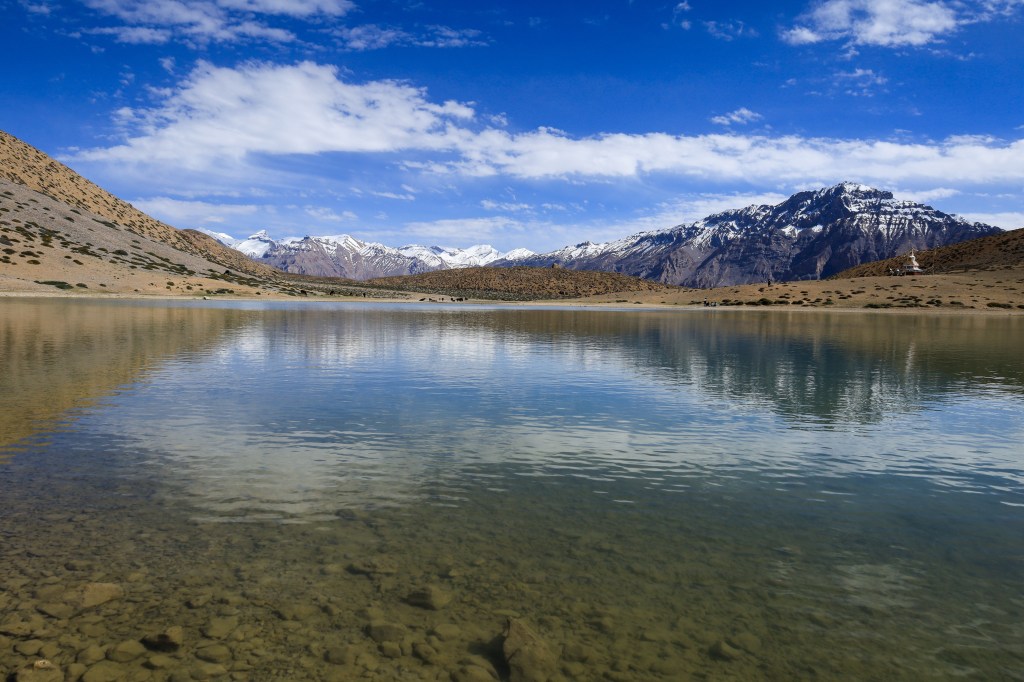
It takes over an hour to drive the 13 miles from the pass to Chandra Taal, or “Lake of the Moon”. Chandra Taal is lake of deep blue and turquoise set against rocky brown slopes and alpine meadows.

Though remote, it’s only a 15 minute walk from the parking area and draws a fair number of tourists. The road to Chandra Taal is only open between June and September when roads are usually passable. Just a couple weeks after my visit, a freak July snowstorm strands hundreds of people here.
We backtrack an hour to get to the main road. In most places, a yellow line on the map means a main artery. In North India, that’s not so much the case. The “main road” is often times the only road, with ‘road’ being a loose approximation.

If anything, the yellow line gets more challenging. Now in the Lahaul Valley, the road follows alongside the Chenab River. The Spiti Valley is wide, with the road high above the river. The Lahaul is narrower and the road is very close to the much fiercer Chenab.
We hit this stretch at precisely the wrong time. As the sun bears down on the snow up high, over the course of the day the level of the water crossing the roads rises. Small trickles turn into torrents. Now, in late afternoon, our way is crisscrossed with rushing streams. We drive with it, against it, and through it.

Where deeper water covers the road, drivers stop to assess their chances. Drivers and guides commiserate about the best way across and groups of men on overpacked Royal Enfield Motorcycles cue up to cross. One at a time, they gun their engines and tear into the rushing water. Others stand midstream, poised to hold them upright as they topple over. More than a few end up horizontal while we wait our turn.
We’re in a Mahindra – the Indian copy of a Jeep. Others are in the little hatchbacks or big vans. Even with all of our weight and the power of four wheel drive, we’re swept sideways at a couple of the crossings. It’s a little bewildering to be afloat in a car. We sit in tense silence, calling on our higher powers and hoping to feel the wheels catch some traction.
The drivers here are some of the very best. I’ve seen guys in little hatchbacks pull off incredible feats on some of the most dangerous roadway on the planet – and they do it every day.
These are the professional athletes of driving. How many Formula One drivers get out mid-race to fiddle around under the hood?
The “road” is all but impassable now and our driver, Raj, predicts that they’ll probably close it tomorrow before people start getting washed away.
As twilight sets in, we roll up the lip of the valley an onto solid pavement for the first time in days. We all let out a little cheer at the smooth sensation below us and the certainty that we’ll arrive at our this evening on the road an not in river.
The end of the Road

It’s after dark when we finally arrive in Koksar. Our last stop is really more of a waypoint than a destination. We turn in our inner line passes at a security checkpoint and find some rooms in town, the journey all but over.
It’s been a rough day and I’m exhausted from hours of bracing myself against the bumpy road. I can’t imagine how our driver feels. We gather for F last dinner a little roadside dhaba and tuck in early.
The last stretch is an easy one. It’s a little more than an hour back to Manali. The scenery is nice, but it’s not as majestic as we’ve just seen nor as exhilarating as what just traversed.
Travel Pals

After a round of hugs, we each go our own way – not sure if or when we’ll ever cross paths again.
The right travel companions are a godsend. Travel doesn’t always bring out the best in people and this is not easy travel. We were five when we left 10 days ago, but we return as four. Sometimes it just doesn’t work out.
When it’s good, it’s something special. It starts with chance – seemingly random people thrown together in some foreign place at the same time and going in the same direction. Plans are made, and you fall in together to discover somewhere you’ve never been and won’t likely see again – once in a lifetime stuff.
Friendship with fellow travelers is unique. You move very quickly from complete strangers to eschewing privacy and sharing everything. You bond over landscapes and culture. You eat together, sleep together, and, hopefully, laugh a lot together.
And then you go your separate ways.In most cases, you probably won’t meet again – at least in real life. Social media makes it easy to keep tabs on people, but ‘goodbyes’ are just that. There’s no pretense to make plans for the future; no obligation to call birthdays or invite anyone to your wedding.
Its strange to go from sharing a tube of toothpaste in the morning to “Hey, have a nice life,” in the afternoon. But it’s sort of an alignment of the planets that makes the whole thing possible in the first place. It’s truly once in a lifetime stuff. truly once in a lifetime stuff.